Walking stage 5 : Dommelen - Neerpelt | The Dommelpad Nature Route
Walk from Dommelen to Neerpelt on this countryside stage of the Dommelpad.
Starting point: from your location

Show all 5 photos
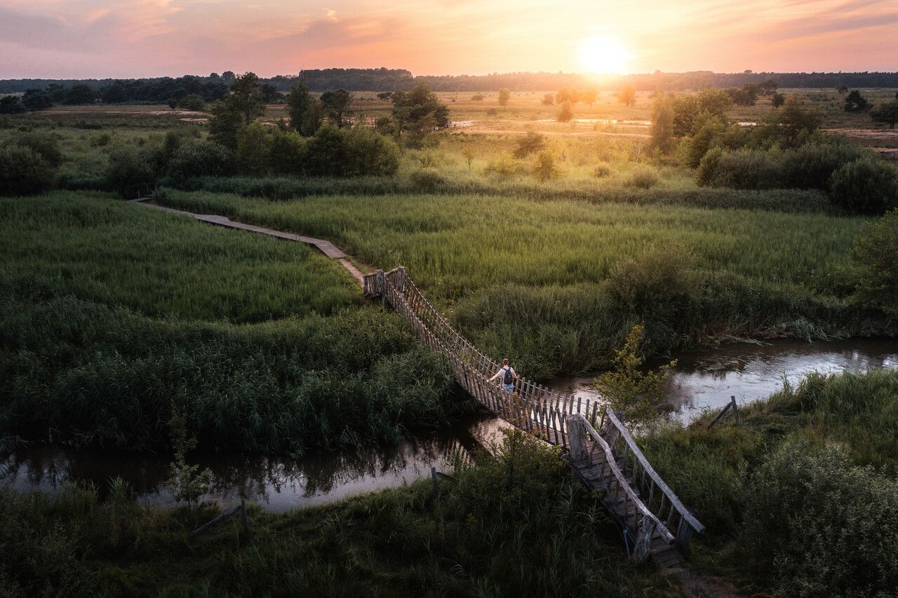
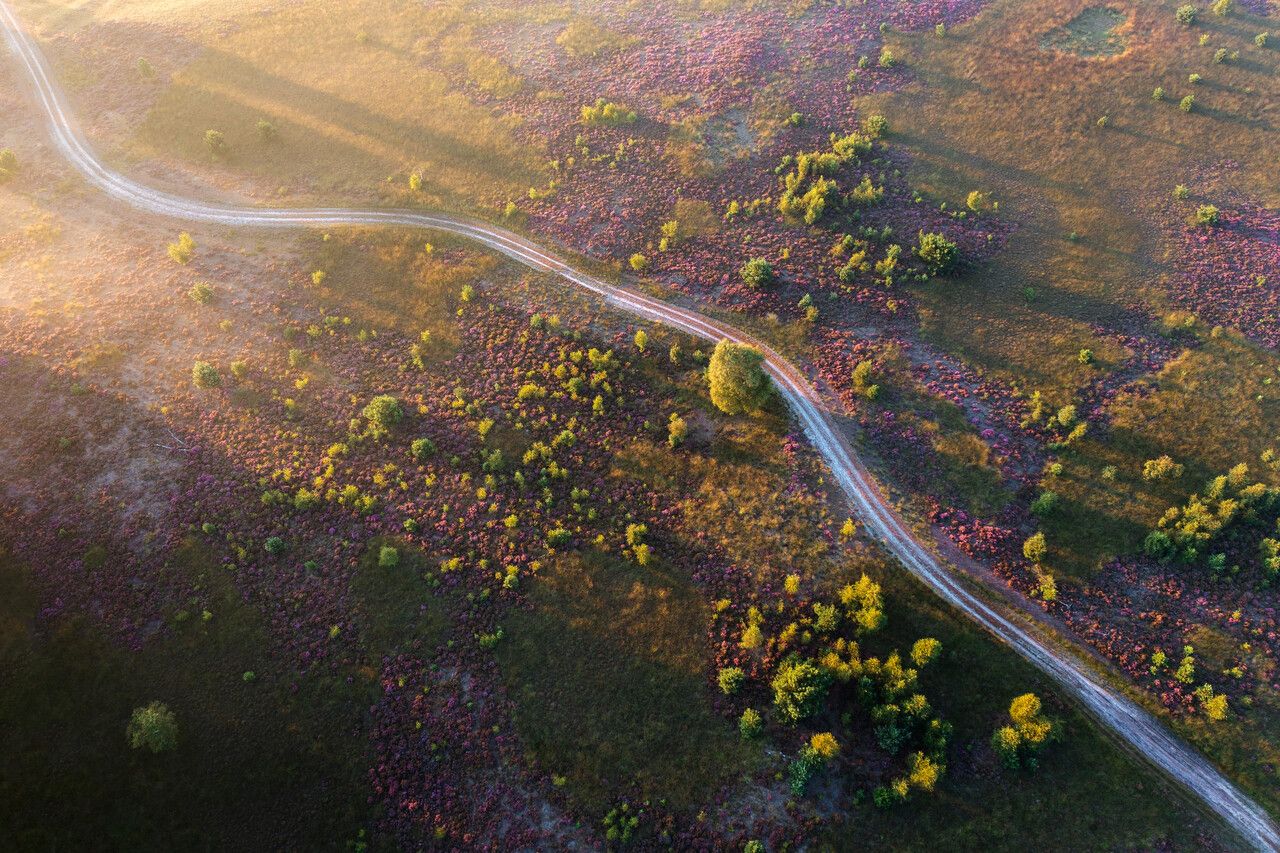
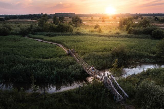
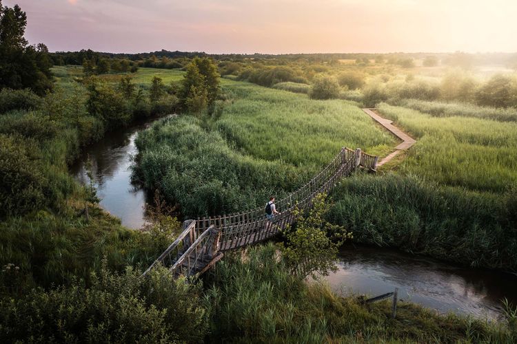
This 23-km route takes you into a Natura 2000 area. You then reach De Groote Heide, a series of nature reserves that extend far beyond the border.
The Dommelpad
The Dommelpad takes you over a distance of 125 kilometres from Peer to ’s-Hertogenbosch and back. During this six-day walking route, you cover 20 kilometres a day on average, following the current from south to north and the story of the windmills. And going upstream from north to south, you follow the story of the countryside.
The Dommel’s natural green gems
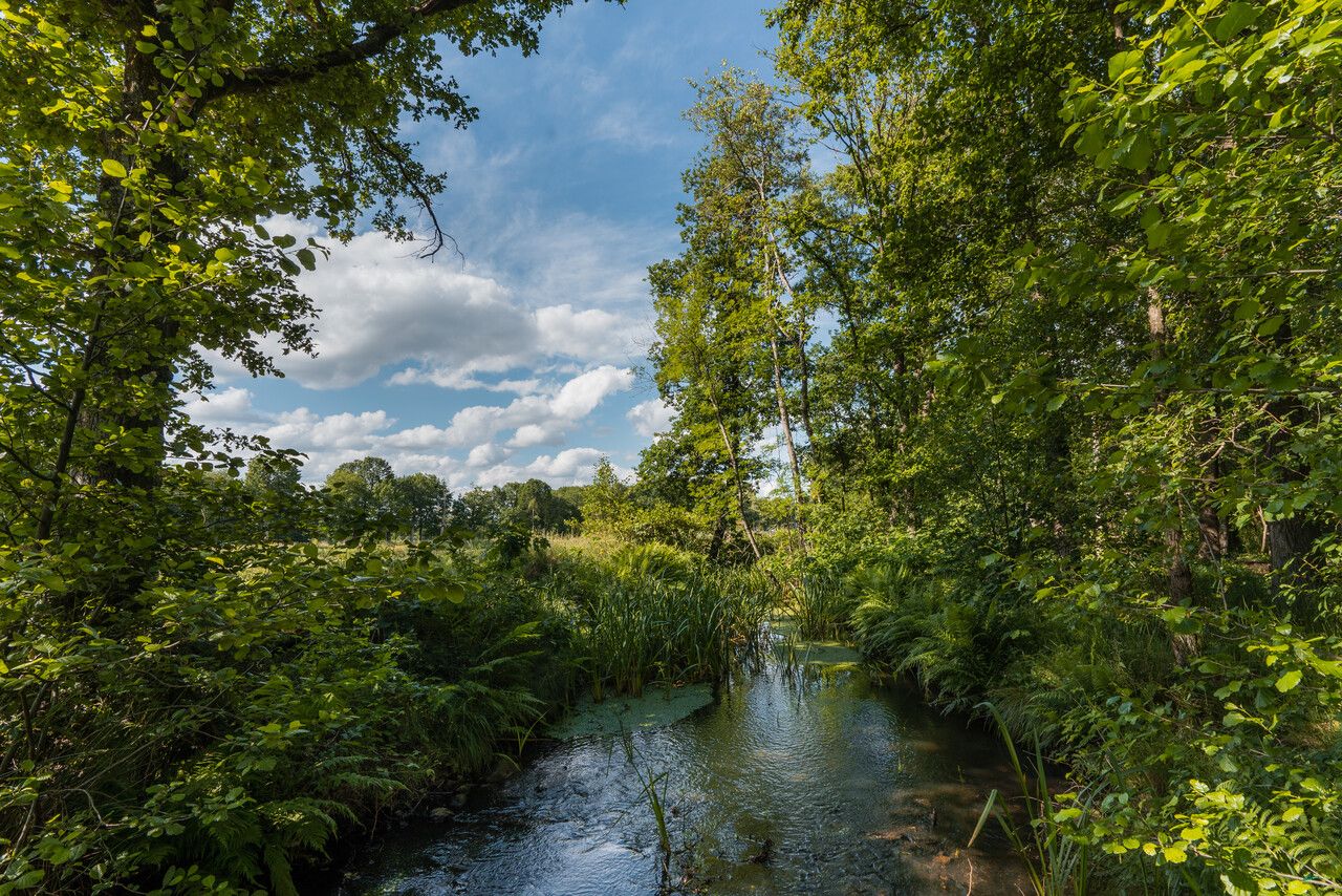
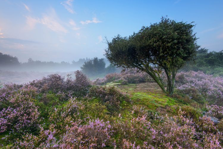
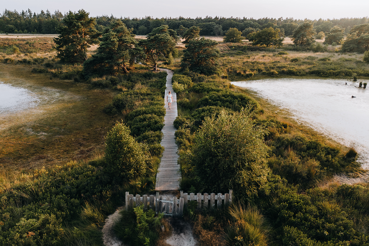
River Dommel’s valley and the adjacent nature reserves are ranked as Natura 2000 areas and are well worth visiting. Following the course of the meandering river, you encounter swampy forests, hayfields, fens, heathlands and many other types of landscapes.
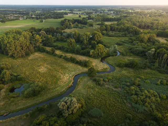
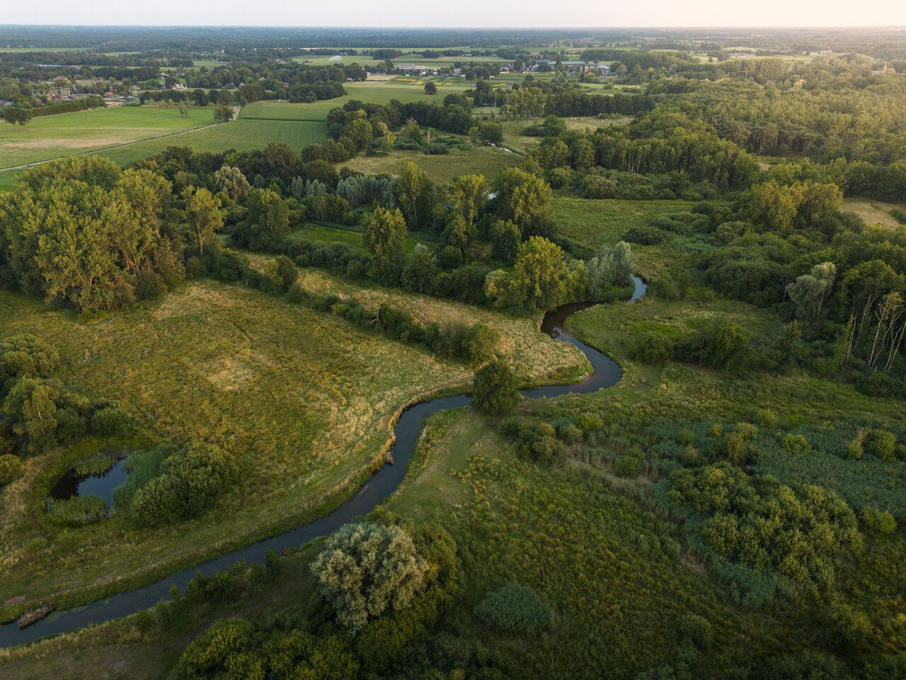
Towards the source
The Dommel originates in Belgium, close to the city of Peer on the Kempens Plateau and ends 120 kilometres further away in the Dutch city of ‘s-Hertogenbosch.
Stream valleys
The water…
This 23-km route takes you into a Natura 2000 area. You then reach De Groote Heide, a series of nature reserves that extend far beyond the border.
The Dommelpad
The Dommelpad takes you over a distance of 125 kilometres from Peer to ’s-Hertogenbosch and back. During this six-day walking route, you cover 20 kilometres a day on average, following the current from south to north and the story of the windmills. And going upstream from north to south, you follow the story of the countryside.
The Dommel’s natural green gems
River Dommel’s valley and the adjacent nature reserves are ranked as Natura 2000 areas and are well worth visiting. Following the course of the meandering river, you encounter swampy forests, hayfields, fens, heathlands and many other types of landscapes.
Towards the source
The Dommel originates in Belgium, close to the city of Peer on the Kempens Plateau and ends 120 kilometres further away in the Dutch city of ‘s-Hertogenbosch.
Stream valleys
The water of a river such as the Dommel leaves its mark on the landscape. A stream valley is characterised by low-lying water surrounded by sandy ground which offers plenty of variation.
Space for the river
In the past few centuries, parts of the Dommel have been straightened to enable the water to drain faster and to reclaim land. This process was reversed at many locations at the beginning of this century, giving the river more space to meander.
De Groote Heide
The Dommelpad runs straight through De Groote Heide, a varied cross-border nature reserve covering 6,000 hectares that extends from Eindhoven in the Netherlands to Pelt in Belgium. The watermills adorning the landscape along River Dommel have partly defined the countryside. Discover the local stories and all the beauty that this border region has to offer on degrooteheide.eu.
About this route
The Dommelpad is set out via the Brabant and Belgian/Flemish walking junction network. Simply walk from one numbered junction to the next. Arrows show you the way between the junctions. If you encounter a problem with the route’s signposting, please report this to us via visitbrabant.com/meldpunt. You can also call 0800-4050050 (free of charge).
-
Hotline routes
Hotline routesIf there is something wrong on the route, report it here.
Sights on this route
Starting point
Bergstraat
5551 ZK Dommelen
Navigate to starting point
De Groote Heide
De Groote Heide is a nature reserve with 6,000 hectares of stunning countryside, including heaths, forests, fens and rivers.
Starting point:
Molenstraat 2115556 TA Valkenswaard
Malpie
A stones throw from Valkenswaard lies nature reserve De Malpie. The unparalleled beauty of this area led to Valkenswaard being voted “Hiking Municipality of the Year” in 2016.
Starting point:
De MalpieMolenstraat 211
5556TA Valkenswaard
Plateaux Hageven
Boundaries blur in Hageven-De Plateaux, a Dutch-Belgian nature reserve. A walk here leads through woods and heathland and past fens and ingenious water meadows, a water system from the early nineteenth century.
Starting point:
Hageven - De PlateauxTussenstraat 10
3910 Neerpelt
End point
Kloosterstraat
3910 Pelt
Navigate to endpoint
- 82
- 81
- 04
- 37
- 84
- 63
- 08
- 68
- 91
- 97
- 96
- 95
- 94
- 93
- 25
- 24
- 22
- 21
- 64
- 96
- 93
- 94
- 95
- 53
- 50
- 46
- 45
- 87
- 85
- 42
- 43
- 41
- 39
Do you like this too?
-
Walking stage 3 : Dommelen - Eindhoven | The Dommelpad Watermill Route
Walking stage 3 : Dommelen - Eindhoven | The Dommelpad Watermill Route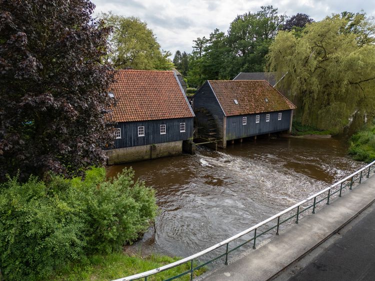 3 hour 54 minutes 17.6 km
Walk from Dommelen to Eindhoven on this watermill stage of the Dommelpad.
-
Walking stage 2 : Neerpelt - Dommelen | The Dommelpad Watermill Route
Walking stage 2 : Neerpelt - Dommelen | The Dommelpad Watermill Route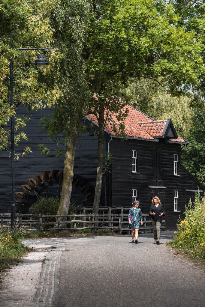 5 hour 6 minutes 23.0 km
Walk from Neerpelt - Dommelen on this watermill stage of the Dommelpad.
-
Walking stage 4 : Eindhoven - Dommelen | The Dommelpad Nature Route
Walking stage 4 : Eindhoven - Dommelen | The Dommelpad Nature Route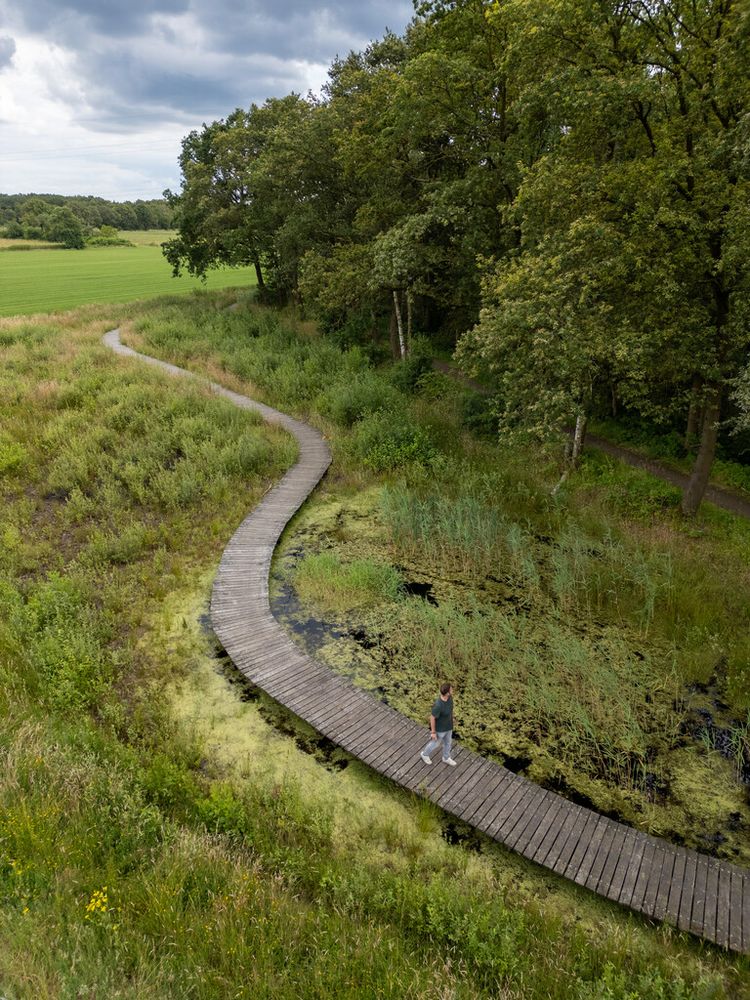 3 hour 54 minutes 17.6 km
Walk from Eindhoven to Dommelen on this countryside stage of the Dommelpad.
-
Walking route 1: Bergeijk – Waalre | Liberation Route Brabant
Walking route 1: Bergeijk – Waalre | Liberation Route Brabant 5 hour 45 minutes 26.0 km
Walk in the liberators’ footsteps around Bergeijk and Waalre.
-
Walking route 2: Waalre – Eindhoven | Liberation Route Brabant
Walking route 2: Waalre – Eindhoven | Liberation Route Brabant 6 hour 27.0 km
Discover the area around Waalre and Eindhoven where the first paratroopers appeared
-
Our Monastery Trail Stage 10 Eindhoven – Vessem
Our Monastery Trail Stage 10 Eindhoven – Vessem 4 hour 53 minutes 22.0 km
This walking route allows amblers to discover the area between Eindhoven and Vessem. This route takes you from Mariënhage Monastery in Eindhoven to...
-
Monastery Walk in De Groote Heide
Monastery Walk in De Groote Heide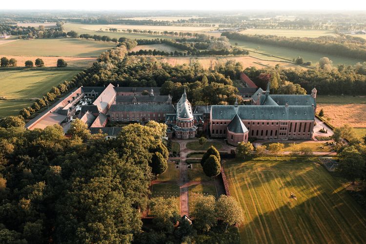 2 hour 30 minutes 11.2 km
This monastery walk will allow you to discover the beautiful countryside around the Achelse Kluis in Hamont-Achel in De Groote Heide heathland.
-
TOP Scenic route Walk Cartierheide
TOP Scenic route Walk Cartierheide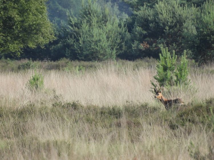 1 hour 30 minutes 6.5 km
Walk this TOP Scenic Route over the Cartierheide heath in the De Kempen natural park. Meet the hospitable locals.