Walking stage 2 : Boxtel - Sint-Oedenrode | The Dommelpad Nature Route
Walk from Boxtel to Sint-Oedenrode on this countryside stage of the Dommelpad
Starting point: from your location


Show all 5 photos
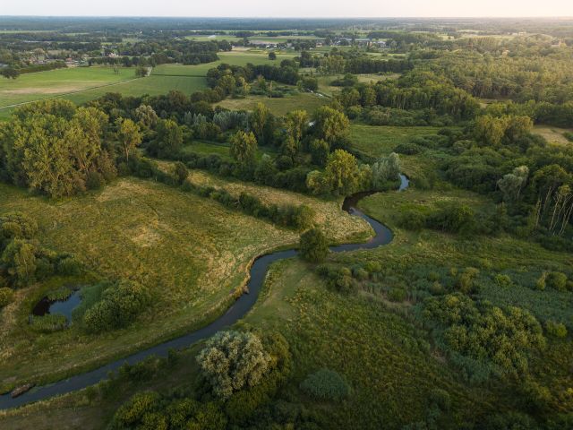
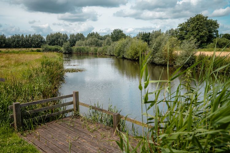
River Dommel has plenty of space to meander in Boxtel. This 15.2-km walking route takes you to these exceptional places. Enjoy the hayfields, wooded banks, heathlands and pools on the way.
The Dommelpad
The Dommelpad takes you over a distance of 125 kilometres from Peer to ’s-Hertogenbosch and back. During this six-day walking route, you cover 20 kilometres a day on average, following the current from south to north and the story of the windmills. And going upstream from north to south, you follow the story of the countryside.
The Dommel’s natural green gems
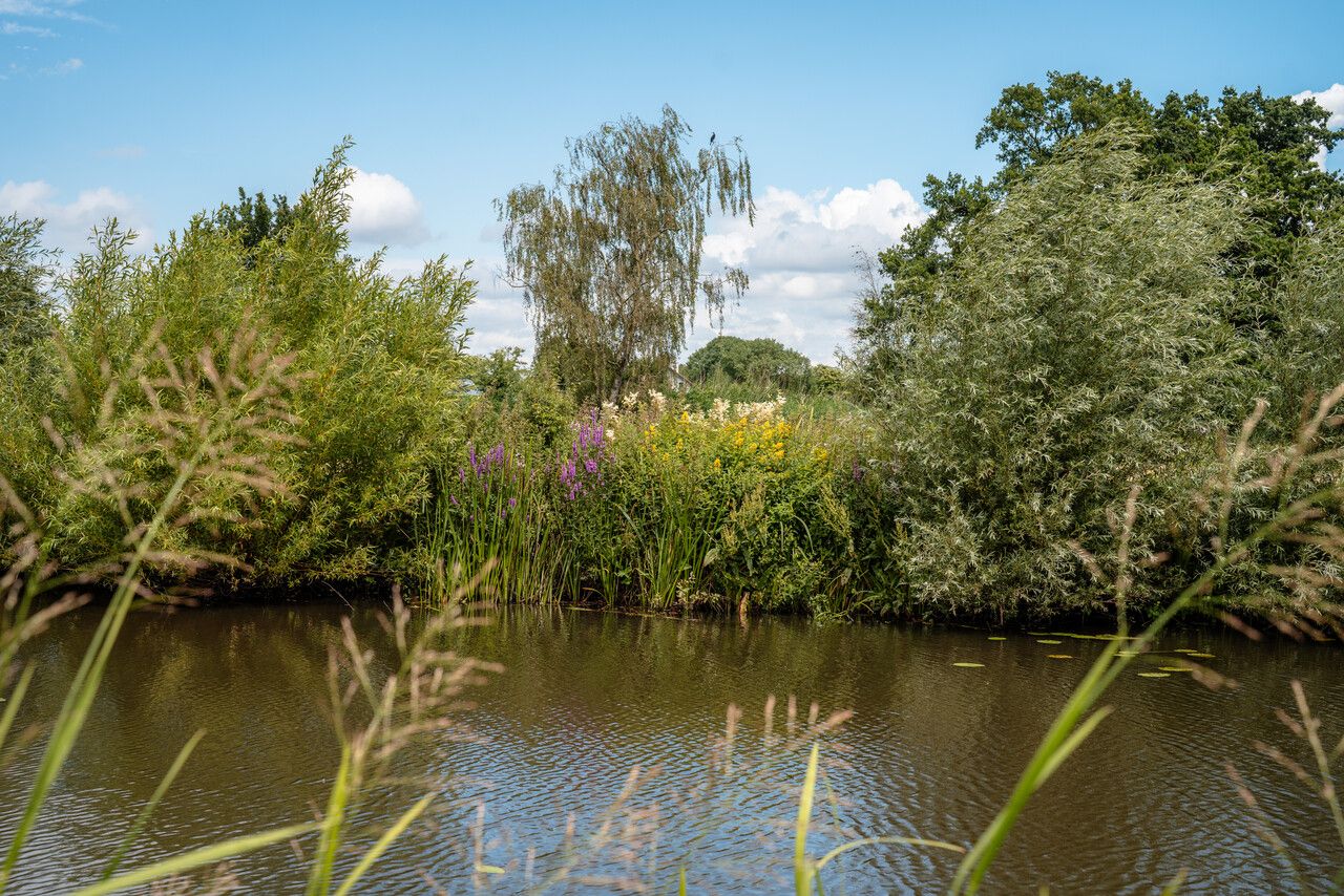
River Dommel’s valley and the adjacent nature reserves are ranked as Natura 2000 areas and are well worth visiting. Following the course of the meandering river, you encounter swampy forests, hayfields, fens, heathlands and many other types of landscapes.
Towards the source
The Dommel originates in Belgium, close to the city of Peer on the Kempens Plateau and ends 120 kilometres further away in the Dutch city of ‘s-Hertogenbosch.
Stream valleys
The …
River Dommel has plenty of space to meander in Boxtel. This 15.2-km walking route takes you to these exceptional places. Enjoy the hayfields, wooded banks, heathlands and pools on the way.
The Dommelpad
The Dommelpad takes you over a distance of 125 kilometres from Peer to ’s-Hertogenbosch and back. During this six-day walking route, you cover 20 kilometres a day on average, following the current from south to north and the story of the windmills. And going upstream from north to south, you follow the story of the countryside.
The Dommel’s natural green gems
River Dommel’s valley and the adjacent nature reserves are ranked as Natura 2000 areas and are well worth visiting. Following the course of the meandering river, you encounter swampy forests, hayfields, fens, heathlands and many other types of landscapes.
Towards the source
The Dommel originates in Belgium, close to the city of Peer on the Kempens Plateau and ends 120 kilometres further away in the Dutch city of ‘s-Hertogenbosch.
Stream valleys
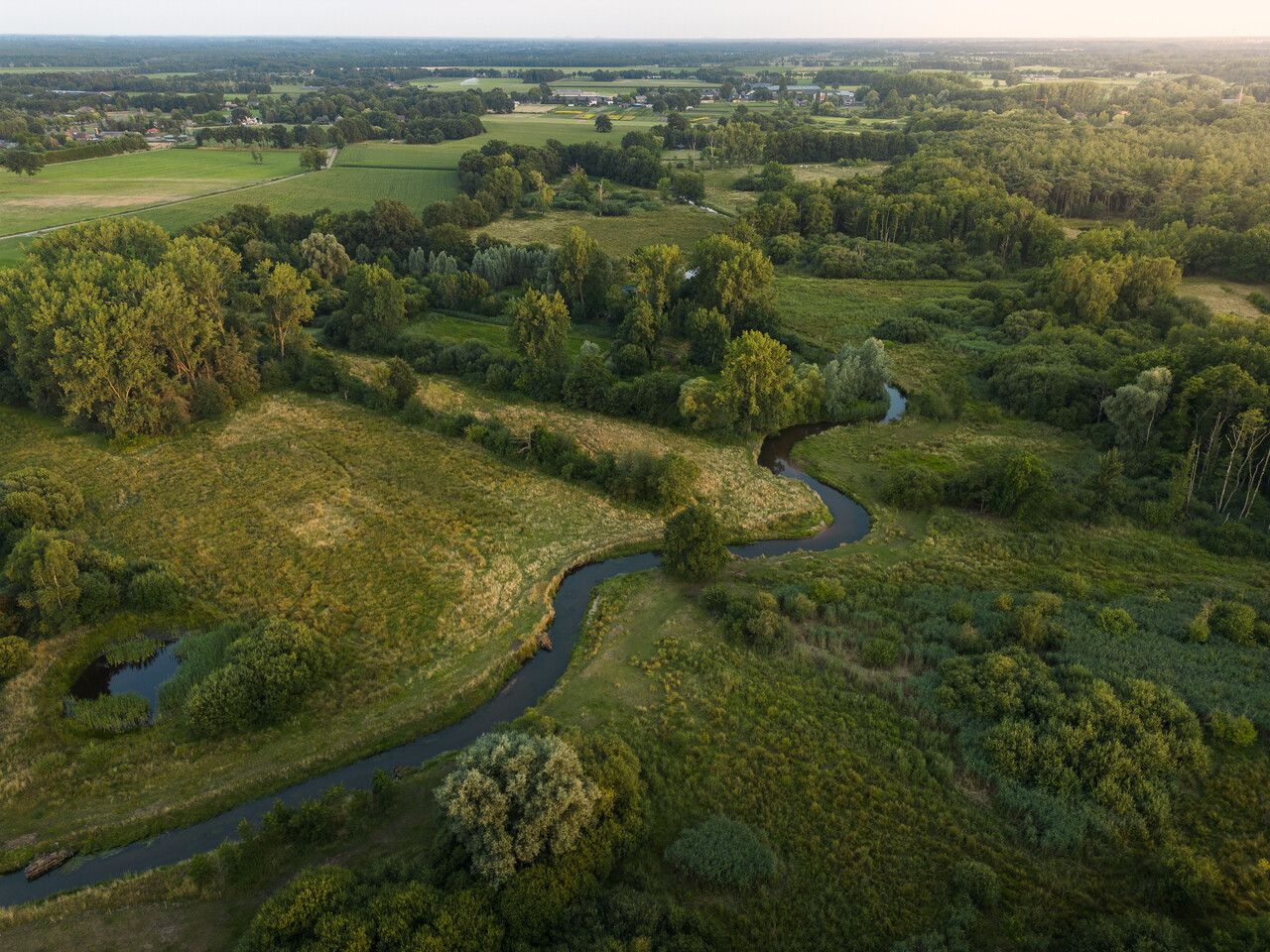
The water of a river such as the Dommel leaves its mark on the landscape. A stream valley is characterised by low-lying water surrounded by sandy ground which offers plenty of variation.
Space for the river
In the past few centuries, parts of the Dommel have been straightened to enable the water to drain faster and to reclaim land. This process was reversed at many locations at the beginning of this century, giving the river more space to meander.
De Groote Heide
The Dommelpad runs straight through De Groote Heide, a varied cross-border nature reserve covering 6,000 hectares that extends from Eindhoven in the Netherlands to Pelt in Belgium. The watermills adorning the landscape along River Dommel have partly defined the countryside. Discover the local stories and all the beauty that this border region has to offer on degrooteheide.eu.
About this route
The Dommelpad is set out via the Brabant and Belgian/Flemish walking junction network. Simply walk from one numbered junction to the next. Arrows show you the way between the junctions. If you encounter a problem with the route’s signposting, please report this to us via visitbrabant.com/meldpunt. You can also call 0800-4050050 (free of charge).
-
Signposting
Simply follow the signs and walk along the route from one numbered junction to the next.
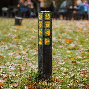
Signposting
Simply follow the signs and walk along the route from one numbered junction to the next.
-
Hotline routes
Hotline routesIf there is something wrong on the route, report it here.
Sights on this route
Starting point:
Waypoint walk 2
Boxtel
Navigate to starting point
Waypoint walk 2
Boxtel
Navigate to starting point
The Dommel valley with carrs and ridge and furrow fields
The stunning Dommel valley landscape is in between the built-up areas of Boxtel and Sint-Oedenrode.
Starting point:
Hoevedreef 25298NS Liempde

The Dommel valley with carrs and ridge and furrow fields
The Dommel valley with carrs and ridge and furrow fields
Hoevedreef 2
5298NS Liempde
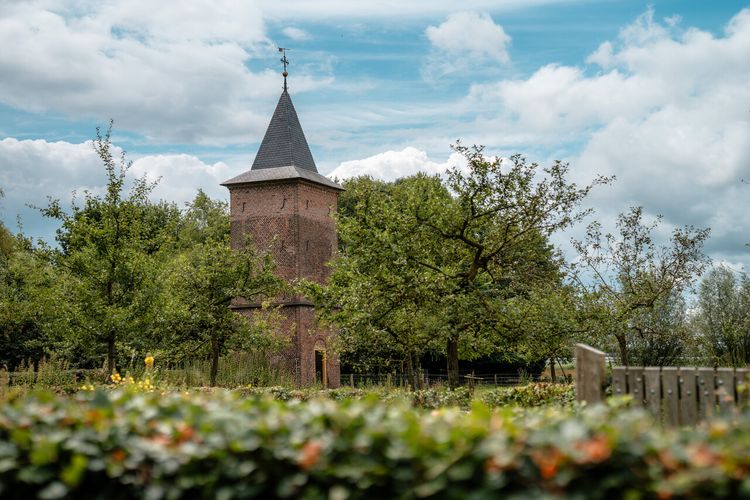
Groot Duijfhuis and dovecote
It was built in the 14th century and when a dovecot was added in the 17th century, it was given the name ‘Groot Duijfhuis’ (Large Dove House).
Starting point:
Hoevedreef 2Liempde
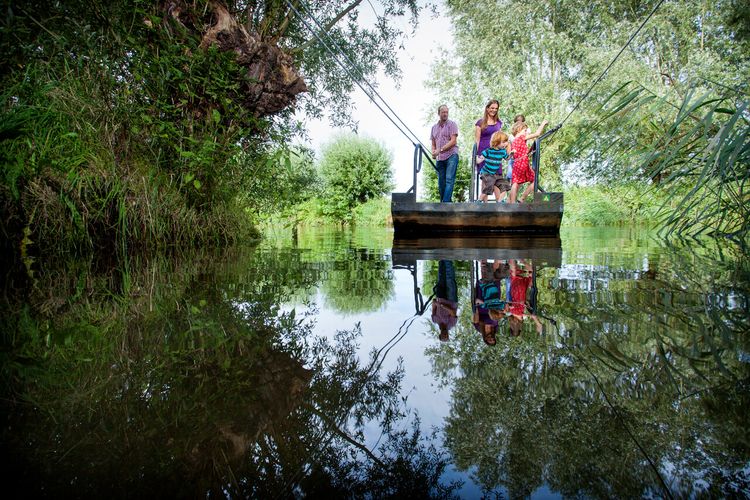
Sint-Janspontje
For centuries, this ferry boat was a short connection between the village of Olland and the hamlet of Kasteren.
Starting point:
DommelsteegjeLiempde
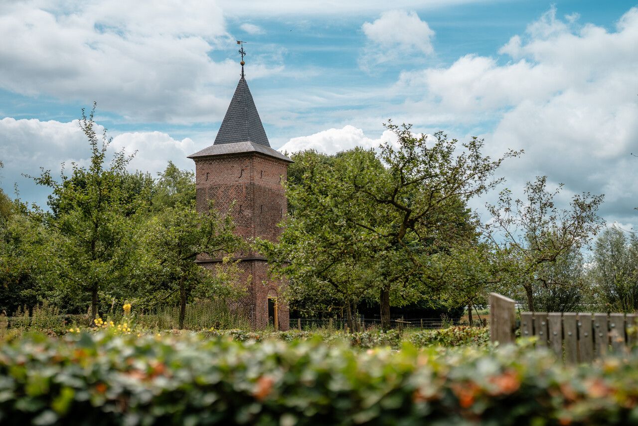
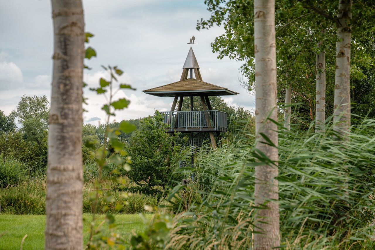
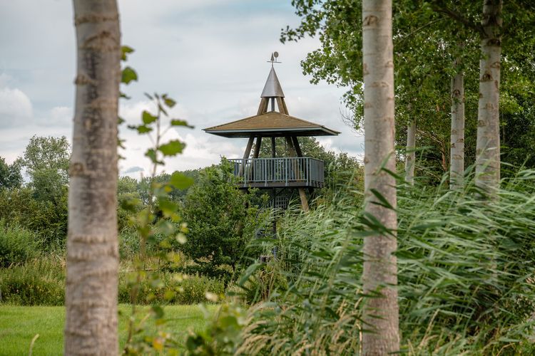
’t Meulke watch tower
Climb ’t Meulke watch tower and view the Dommel valley countryside from above.
Starting point:
MeulekenswegLiempde
De Meierij ‘Peppellandschap’
The poplar trees, sandy paths and wet marsh grounds together form the well-known De Meierij ‘peppellandschap’ or ‘poplar landscape’.
Starting point:
MeulekenswegLiempde
End point:
Waypoint walk 27
Sint-Oedenrode
Navigate to endpoint
Waypoint walk 27
Sint-Oedenrode
Navigate to endpoint
- 2
- 22
- 24
- 25
- 26
- 27
- 8
- 6
- 5
- 3
- 1
- 9
- 11
- 86
- 55
- 54
- 81
- 80
- 1
- 34
- 31
- 30
- 64
- 27